

|
Janus [JAY-nus] is the sixth satellite of Saturn. It was discovered by Audouin Dollfus in 1966 and was named after the god of gates and doorways. It is depicted with two faces looking in opposite directions. Janus has an irregular shape with a size of 196x192x150 kilometers (122x119x93 miles) in diameter. It is heavily cratered with several craters 30 kilometers (19 miles) in diameter. The pervasive cratering indicates that its surface must be several billion years old. Prometheus appears to have fewer craters indicating a younger surface while Pandora appears to have an older surface. Janus has few linear features.
Janus and Epimetheus share the same orbit of 151,472 kilometers (94,125 miles) from Saturn's center or 91,000 kilometers (56,547 miles) above the cloud tops. They are only separated by about 50 kilometers (31 miles). As these two satellites approach each other they exchange a little momentum and trade orbits; the inner satellite becomes the outer and the outer moves to the inner position. This exchange happens about once every four years. Janus and Epimetheus may have formed from a disruption of a single parent to form co-orbital satellites. If this is the case, the disruption must have happened early in the history of the satellite system.
| Animations of Janus |
|---|
| Views of Janus |
|---|
 Janus
Janus
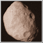
This image of Janus was acquired by the Voyager 2 spacecraft on
August 25, 1981. It is the highest resolution image available.
(Credit: Calvin J. Hamilton)
 Janus
Janus
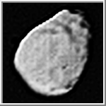
This image of Janus was acquired by the Voyager 1 spacecraft on
November 12, 1981.
(Credit: Calvin J. Hamilton)
 Topographic Map of Janus
This is a topographic map of Janus. It is based upon the shape model by Phil
Stooke. As with all maps, it is the cartographer's interpretation;
not all features are necessarily certain given the limited data
available. This interpretation stretches the data as far as possible.
(Courtesy A. Tayfun Oner)
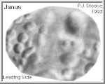
 Conformal Projection of Janus
This image is a shaded relief map of Janus, the larger co-orbital
satellite of Saturn. As with all maps, it is the cartographer's
interpretation and not all features are necessarily certain given the
limited data available. This interpretation stretches the data as far as
is feasible. The image shows two different views of Janus in a
Morphographic Conformal Projection. One view shows the
leading side and the
other the trailing side.
(Courtesy Phil Stooke/NSSDC/NASA)
| References |
|---|
Stooke, P. J. and Lumsdon, M. P., "The Topography of Janus," Earth, Moon and Planets, 62 (1993), 223-237.
Copyright © 1997 by Calvin J. Hamilton. All rights reserved.